Dissolved Oxygen
- Reference Designator
- GS05MOAS-PG565-02-DOSTAM000
- Start Depth
- 0
- End Depth
- 200
- Location
- Current Status
- Review Complete
- M2M Example
- https://ooinet.oceanobservatories.org/api/m2m/12576/sensor/inv/GS05MOAS/PG565/02-DOSTAM000/metadata
| Method | Data Stream | Content | Type | |
|---|---|---|---|---|
| recovered_host | dosta_abcdjm_glider_recovered | Data Products | Report M2M Stats | Science |
| telemetered | dosta_abcdjm_glider_instrument | Data Products | Report M2M Stats | Science |
| Deployment | Cruise | Start Date | Stop Date | Mooring Asset | Node Asset | Sensor Asset | Latitude | Longitude | Deployment Depth | Water Depth |
|---|---|---|---|---|---|---|---|---|---|---|
| 1 Review | NBP-15-11 | 12/20/2015 | 11/21/2016 | CGVGS-05MOAS-00000 | CGVEH-GLDRGP-00565 | CGINS-DOSTAM-00437 | -54.1252 | -89.7625 | 200 | 200 |
| Metadata | Start Date | End Date | Comment |
|---|---|---|---|
|
GS05MOAS |
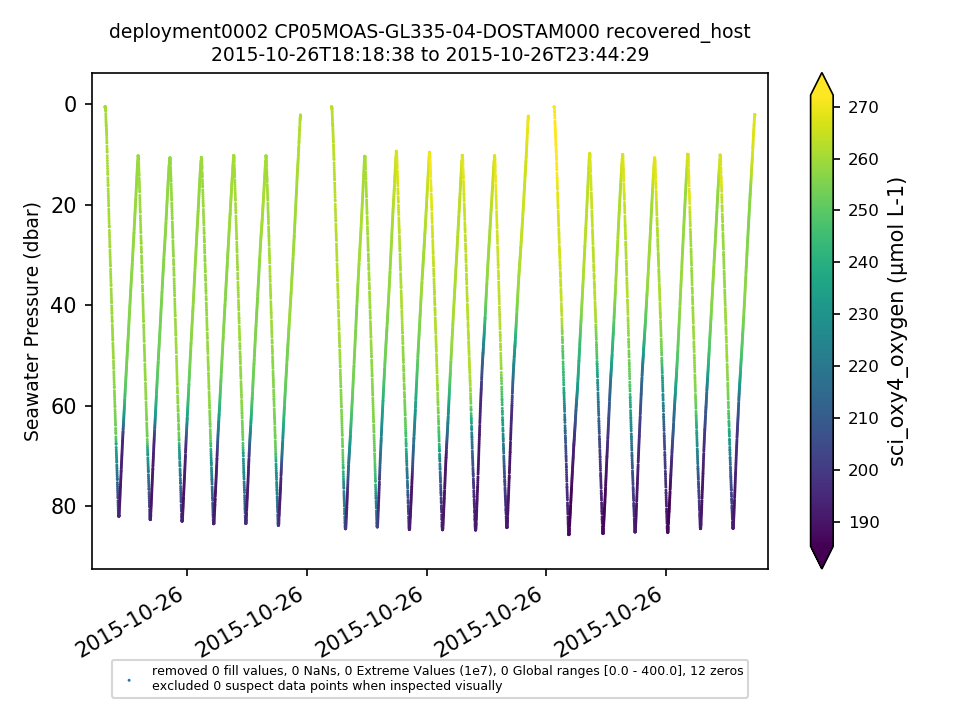
Glider optodes typically exhibit a sensor lag of 20-25 seconds. Example attached of several segments with consecutive down and up casts for CP05MOAS-GL335-04-DOSTAM000 on 10/26/2015 showing a typical measurement time lag. Profiles should be analyzed for individual time lags and data should be adjusted. OOI doesn't necessarily need to make the adjustment but users should be aware of the issue. By Lori Garzio, on 5/31/19 |
||
|
GS05MOAS-PG565-02-DOSTAM000 |
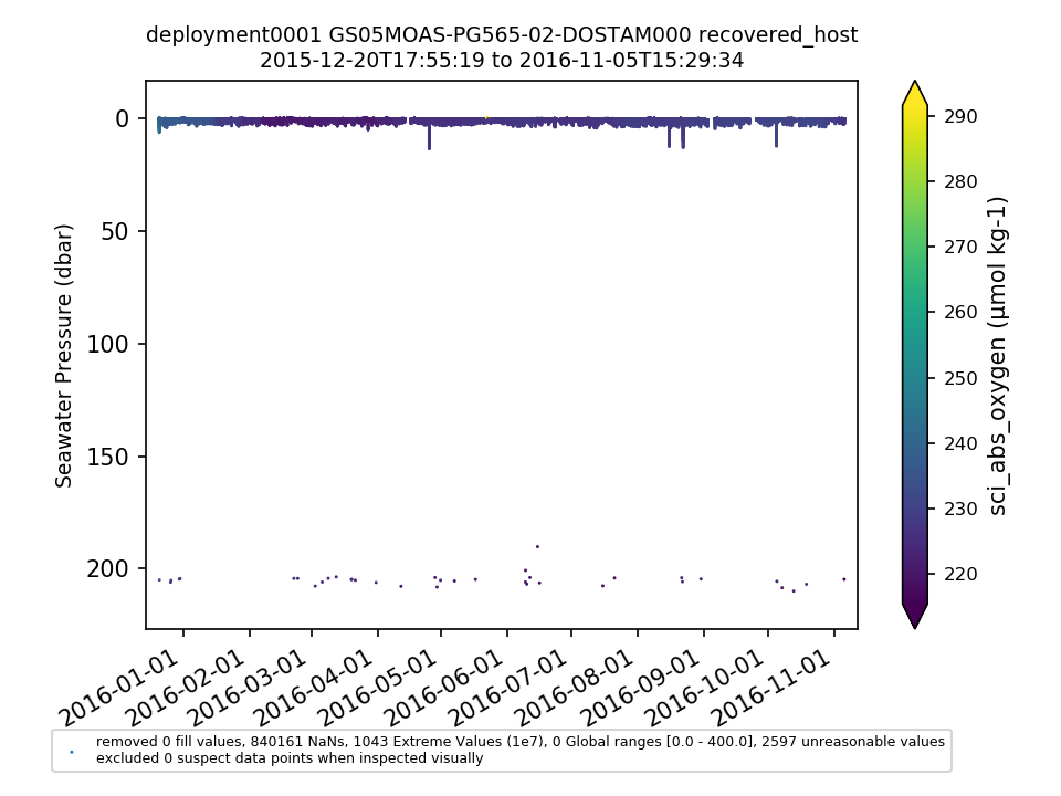
Comparison with the shipboard CTD cast was done for D0001. The shipboard CTD cast data are corrected for temperature, salinity, and depth (Redmine 14230). The L2 DO data product (corrected for temperature, salinity and depth) is substantially lower for the glider compared to the shipboard data. This could be related to the issue of incorrect default salinity settings on some glider optodes (Redmine 13575). Comparison to the shipboard bottle data is outside the scope of this project. Note: the conversion from ml/l to umol/kg for the shipboard DO = DO (ml/l) * 44.661 / 1.025. By Lori Garzio, on 3/11/19 |
||
|
GS05MOAS-PG565-02-DOSTAM000 |
| Metadata | Start Date | End Date | Comment |
|---|---|---|---|
|
GS05MOAS-PG565 |
12/20/15, 12:56 PM | 11/5/16, 9:02 PM |
Deployment 1: Deployed on 12/20/2015, recovered on 12/25/2015 20:40 UTC for ballast correction and was re-deployed. Starting around 5/1/2016, glider became increasingly difficult to steer. Glider stopped profiling on 11/6/2016 to conserve remaining battery power. At recovery, barnacles were present mostly on the underside of the glider, and were not in an area to hinder flight performance. Id: 577 By: lgarzio |


