Coastal Glider 374
- Reference Designator
- CP05MOAS-GL374
- Mobile Asset Controller (CP05MOAS-GL374-00-ENG000000)
- Velocity Profiler (600kHz) (CP05MOAS-GL374-01-ADCPAM000)
- 3-Wavelength Fluorometer (CP05MOAS-GL374-02-FLORTM000)
- CTD (CP05MOAS-GL374-03-CTDGVM000)
- Dissolved Oxygen (CP05MOAS-GL374-04-DOSTAM000)
- Photosynthetically Available Radiation (CP05MOAS-GL374-05-PARADM000)
| Deployment | Cruise | Start Date | Stop Date | Mooring Asset | Node Asset | Sensor Asset | Latitude | Longitude | Deployment Depth | Water Depth |
|---|---|---|---|---|---|---|---|---|---|---|
| 1 | KN-217 | 04/16/2014 | 07/11/2014 | CGVEH-GLDRCP-00374 | 40.1115 | -70.5555 | ||||
| 2 | AT-27 | 05/09/2015 | 07/24/2015 | CGVEH-GLDRCP-00374 | 39.9418 | -70.8266 | ||||
| 3 | AR-04 | 05/29/2016 | 08/09/2016 | CGVEH-GLDRCP-00374 | 40.1195 | -70.4483 | ||||
| 4 | AR-08 | 10/11/2016 | 12/20/2016 | CGVEH-GLDRCP-00374 | 40.0873 | -70.3782 | ||||
| 5 | SI20170418 | 04/20/2017 | 04/20/2017 | CGVEH-GLDRCP-00374 | 40.0288 | -70.4857 |
| Metadata | Start Date | End Date | Comment |
|---|---|---|---|
|
CP05MOAS |
Bad altimeter pings are apparent in many deployments of the coastal gliders. A few example plots are attached - m_water_depth plotted as semi-transparent bathymetry. By Lori Garzio, on 5/10/19 |
||
|
CP05MOAS |
Glider optodes typically exhibit a sensor lag of 20-25 seconds. Example attached of several segments with consecutive down and up casts for CP05MOAS-GL335-04-DOSTAM000 on 10/26/2015 showing a typical measurement time lag. Profiles should be analyzed for individual time lags and data should be adjusted. OOI doesn't necessarily need to make the adjustment but users should be aware of the issue. By Lori Garzio, on 5/15/19 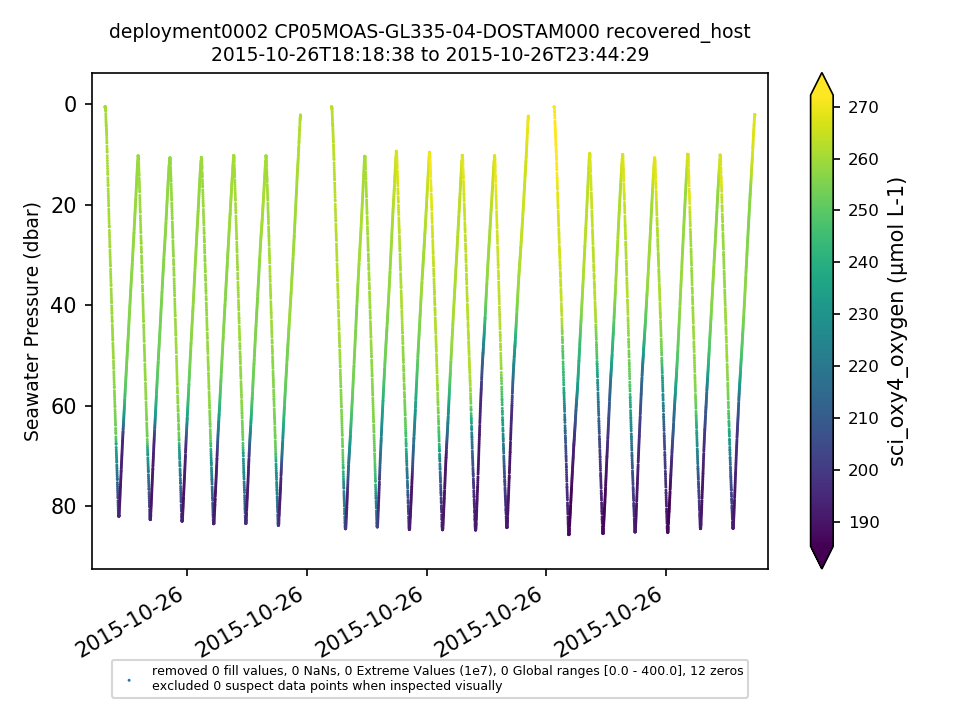 |
||
|
CP05MOAS-GL374 Deployment: 4 |
Glider looks like it drifted at the end of the deployment - this should be annotated By Lori Garzio, on 9/3/19 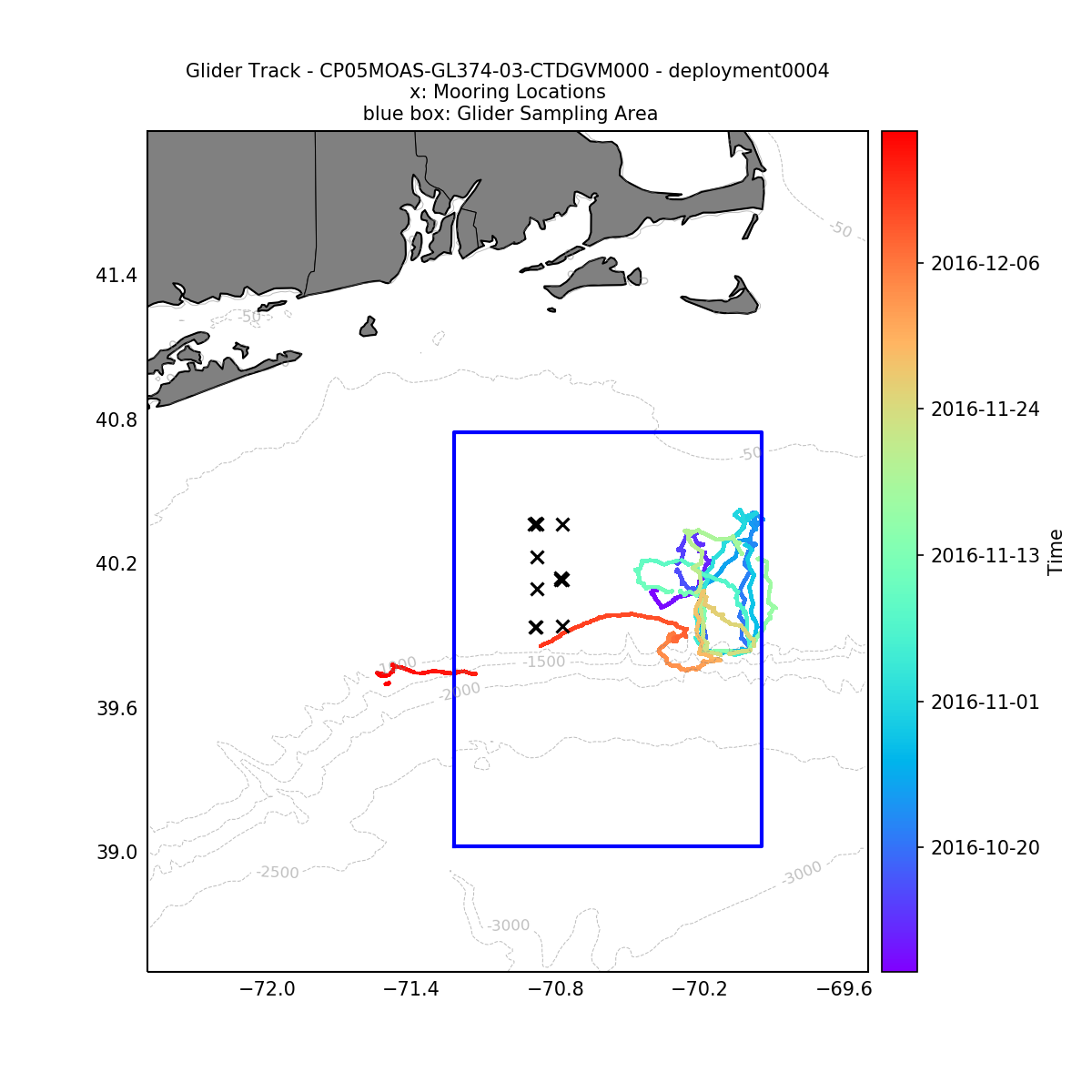 |
No annotations yet.