CTD
- Reference Designator
- CE05MOAS-GL319-05-CTDGVM000
- Review Status
- Review Complete
- Note
- Depth
- 0 to 1,000m
- Class
- CTDGV (CTD Glider)
- Make / Model
- Sea-Bird / SBE Glider Payload CTD (GP-CTD)
Dataset Reviews Last processed: 4/10/19, 3:42 PM
| Dep. | Preferred Method | Stream | DD | FD | SG | EG | Gaps | GD | TS | Rate (s) | Pressure Comp. | Time Order | Valid Data | Missing Data | Data Comp. | Missing Coords. | Review |
|---|---|---|---|---|---|---|---|---|---|---|---|---|---|---|---|---|---|
| 1 | recovered_host | 39 | 38 | 0 | 0 | 0 | 0 | 1,053,812 | 2 | 200 / 167 | Complete | ||||||
| 3 | recovered_host | 46 | 44 | 0 | 1 | 0 | 0 | 442,547 | 2 | 200 / 196 | 1 | Complete | |||||
| 4 | recovered_host | 9 | 8 | 0 | 0 | 2 | 2 | 92,209 | 2 | 200 / 125 | Complete | ||||||
| 5 | recovered_host | 43 | 40 | 0 | 3 | 0 | 0 | 812,782 | 2 | 200 / 203 | Complete | ||||||
| 6 | recovered_host | 23 | 15 | 0 | 0 | 4 | 10 | 181,972 | 2 | 200 / 201 | Complete |
Test Notes
- missing: ['lon', 'lat', 'pressure']
Data Coverage
| Deployment: | 1 | 3 | 4 | 5 | 6 |
|---|---|---|---|---|---|
| 97% | 96% | 89% | 93% | 65% |
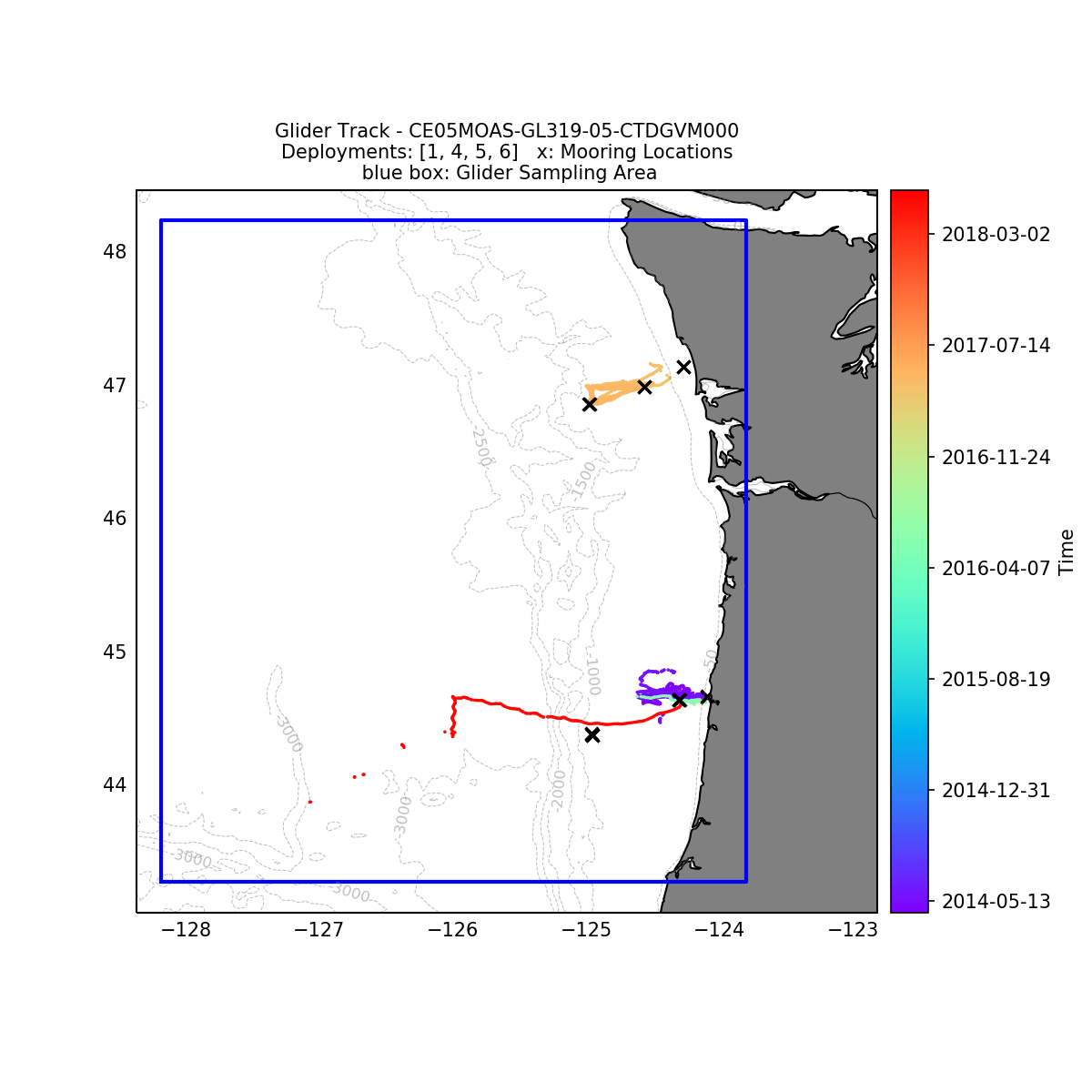
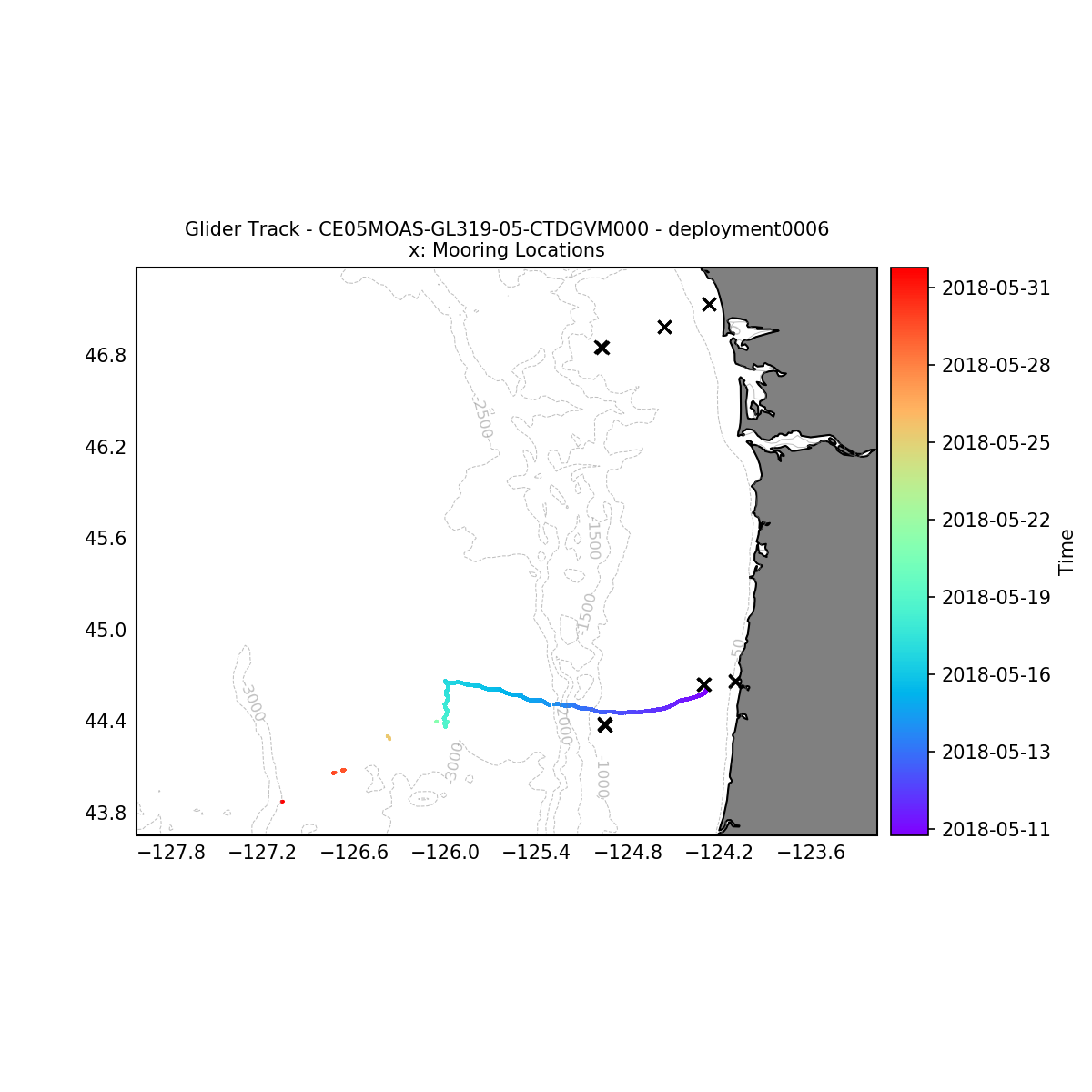
Deployment Map

System Annotations Show
| Metadata | Start Date | End Date | Comment |
|---|---|---|---|
|
CE05MOAS-GL319 |
10/26/15, 8:00 PM | 11/17/15, 7:00 PM |
Unintended sampling pattern changed, possibly caused by the ADCP. When the ADCP was turned off, the other sensors on the glider appeared to work properly again.
Id: 1371
By: lgarzio
|
|
CE05MOAS-GL319 |
11/19/15, 7:00 PM | 11/21/15, 7:00 PM |
Deployment 3 - buoyancy pump failure and leak in fwd compartment, recovered early on 11/22/2015
Id: 889
By: michaesm
|
|
CE05MOAS-GL319 |
6/19/16, 8:00 PM | 6/20/16, 8:00 PM |
Glider 319 recovered 2016-06-18 6pm PDT 5.4 nm west of Newport by a recreational fisherman. The glider was returned to OSU Sunday morning undamaged, and was redeployed on 2016-06-21.
Id: 888
By: michaesm
|
Review Notes
| Metadata | Start Date | End Date | Comment |
|---|---|---|---|
|
CE05MOAS |
Bad altimeter pings are apparent in many deployments of the coastal gliders. A few example plots are attached - m_water_depth plotted as semi-transparent bathymetry. By Lori Garzio, on 5/10/19 |
||
|
CE05MOAS |
Glider optodes typically exhibit a sensor lag of 20-25 seconds. Example attached of 3 consecutive down and up casts for CE05MOAS-GL312-04-DOSTAM000 on 7/8/2014 showing a typical measurement time lag. Profiles should be analyzed for individual time lags and data should be adjusted. OOI doesn't necessarily need to make the adjustment but users should be aware of the issue. By Lori Garzio, on 5/14/19 |
||
|
CE05MOAS-GL319 |
Deployment 2 was a test deployment - no data available. By Lori Garzio, on 4/22/19 |
||
|
CE05MOAS-GL319-05-CTDGVM000 Deployment: 3 |
No data for sci_seawater_density. According to the computed_provenance error: "missing": [ By Lori Garzio, on 4/22/19 |
||
|
CE05MOAS-GL319 Deployment: 3 |
The deployment 3 .nc files for every instrument are missing coordinates lat, lon, and pressure. By Lori Garzio, on 4/25/19 |
||
|
CE05MOAS-GL319-05-CTDGVM000 Deployment: 4 |
|||
|
CE05MOAS-GL319 Deployment: 4 |
6/19/16, 12:00 AM | 6/22/16, 12:00 AM |
Glider was out of the water (see annotation ID 888 - fisherman picked it up) - any data available during this time range should be flagged as "bad". By Lori Garzio, on 4/25/19 |
|
CE05MOAS-GL319-05-CTDGVM000 Deployment: 5 |
|||
|
CE05MOAS-GL319-05-CTDGVM000 Deployment: 6 |
|||
|
CE05MOAS-GL319 Deployment: 6 |
5/20/18, 12:00 AM | 6/1/18, 3:22 PM |


