Spectral Irradiance
- Reference Designator
- CE09OSSM-RID26-08-SPKIRB000
- Start Depth
- 7
- End Depth
- 7
- Location
- Near Surface Instrument Frame
- Current Status
- Review Complete
- M2M Example
- https://ooinet.oceanobservatories.org/api/m2m/12576/sensor/inv/CE09OSSM/RID26/08-SPKIRB000/metadata
| Method | Data Stream | Content | Type | |
|---|---|---|---|---|
| recovered_host | spkir_abj_dcl_instrument_recovered | Data Products | Report M2M Stats | Science |
| telemetered | spkir_abj_dcl_instrument | Data Products | Report M2M Stats | Science |
| Deployment | Cruise | Start Date | Stop Date | Mooring Asset | Node Asset | Sensor Asset | Latitude | Longitude | Deployment Depth | Water Depth |
|---|---|---|---|---|---|---|---|---|---|---|
| 1 Review | OC1503D | 04/09/2015 | 09/25/2015 | CGMCE-09OSSM-00001 | CGINS-SPKIRB-00250 | 46.8539 | -124.958 | 7 | 542 | |
| 2 Review | OC1510A | 10/15/2015 | 05/07/2016 | CGMCE-09OSSM-00002 | CGINS-SPKIRB-00254 | 46.8531 | -124.954 | 7 | 542 | |
| 3 Review | TN-342 | 05/12/2016 | 09/22/2016 | CGMCE-09OSSM-00003 | CGINS-SPKIRB-00298 | 46.8537 | -124.961 | 7 | 542 | |
| 4 Review | AT37-03 | 09/20/2016 | 04/14/2017 | CGMCE-09OSSM-00004 | CGINS-SPKIRB-00243 | 46.8508 | -124.972 | 7 | 542 | |
| 5 Review | SKQ201704S | 04/12/2017 | 10/06/2017 | CGMCE-09OSSM-00005 | CGINS-SPKIRB-00255 | 46.8529 | -124.959 | 7 | 542 | |
| 6 Review | SKQ201715S | 10/04/2017 | 03/30/2018 | CGMCE-09OSSM-00006 | CGINS-SPKIRB-00249 | 46.8478 | -124.984 | 7 | 542 | |
| 7 Review | SKQ201808S | 03/26/2018 | 09/19/2018 | CGMCE-09OSSM-00007 | CGINS-SPKIRB-00255 | 46.853 | -124.958 | 7 | 554 | |
| 8 Review | SR1813 | 09/19/2018 | 04/25/2019 | CGMCE-09OSSM-00008 | CGINS-SPKIRB-00243 | 46.849 | -124.978 | 7 | 542 | |
| 9 Review | SKQ201910S | 04/24/2019 | 10/13/2019 | CGMCE-09OSSM-00009 | CGINS-SPKIRB-00232 | 46.8527 | -124.954 | 7 | 542 | |
| 10 Review | SKQ201921S | 10/11/2019 | CGMCE-09OSSM-00010 | CGINS-SPKIRB-00242 | 46.865 | -124.948 | 7 | 542 |
| Metadata | Start Date | End Date | Comment |
|---|---|---|---|
|
CE09OSSM-RID26-08-SPKIRB000 |
There is no pressure variable in the .nc files. This should be a coordinate. By Lori Garzio, on 7/12/19 |
||
|
CE09OSSM-RID26-08-SPKIRB000 |
A substantial percentage (between 17-42%) of data are outside of global ranges for every deployment. Zooming in on the x-axis in the plots shows that all of the values that are outside of global ranges are negative. By Lori Garzio, on 7/12/19 |
||
|
CE09OSSM-RID26-08-SPKIRB000 |
The missing data for deployments 1, 2 and 7 should be annotated. By Lori Garzio, on 7/12/19 |
||
|
CE09OSSM-RID26-08-SPKIRB000 Deployment: 4 |
3/1/17, 12:00 AM | 4/14/17, 3:17 PM |
Suspect data - signal started to decrease starting in March 2017. This should be investigated and annotated. By Lori Garzio, on 7/12/19 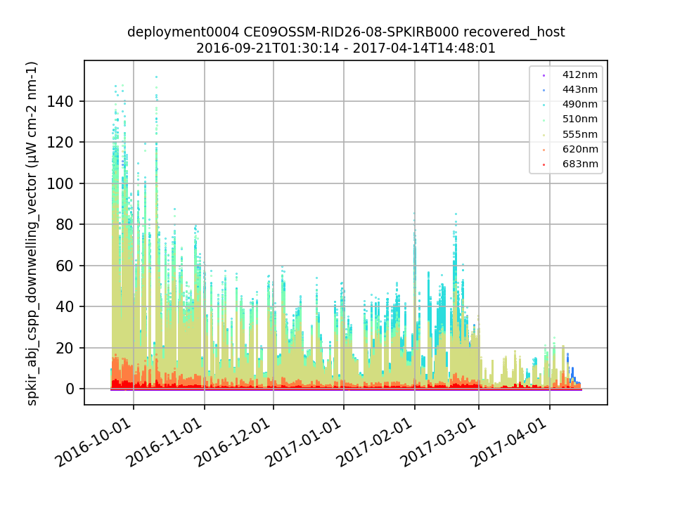 |
| Metadata | Start Date | End Date | Comment |
|---|---|---|---|
|
CE09OSSM-RID26-08-SPKIRB000 |
7/4/19, 11:45 AM | 10/11/19, 6:59 PM |
The instrument appears to be intermittenly failing to turn on resulting in several missed sampling periods. When it does turn on, it appears as if the bioshutter, in a number of cases, may not be opening. Result is the occasional daytime irradiance measurements of ~0. Users will need to be cautious when using this data for the remainder of the deployment.
Id: 1694
By: wingardc
|
|
CE09OSSM-RID26-08-SPKIRB000 |
10/11/19, 6:59 PM |
The use of UV lamps has been implemented for biofouling mitigation on this instrument as of 2019-10-11T22:59:00Z. Id: 2125 By: wingardc |
|
|
CE09OSSM-RID26 Method: telemetered |
4/27/20, 3:40 PM |
We are experiencing an intermittent failure of communication between the systems on the NSIF and the buoy. While the systems on the NSIF are operating, due to a change in the telemetry system, only a finite backlog of data is telemetered to shore. As a result, when communications are restored, some of the data backlog may be missing and there may be gaps in the record. Id: 2183 By: wingardc |
|
|
CE09OSSM Method: telemetered |
5/9/20, 8:40 PM | 5/10/20, 8:00 PM |
Due to a bug in the mooring telemetry system, data during this time range was not telemetered to shore. It was recorded on the mooring and instruments and will be available in the recovered data streams.
Id: 2182
By: wingardc
|