Dissolved Oxygen
- Reference Designator
- CE05MOAS-GL386-04-DOSTAM000
- Start Depth
- 0
- End Depth
- 1,000
- Location
- Current Status
- Review Complete
- M2M Example
- https://ooinet.oceanobservatories.org/api/m2m/12576/sensor/inv/CE05MOAS/GL386/04-DOSTAM000/metadata
| Method | Data Stream | Content | Type | |
|---|---|---|---|---|
| recovered_host | dosta_abcdjm_glider_recovered | Data Products | Report M2M Stats | Science |
| telemetered | dosta_abcdjm_glider_instrument | Data Products | Report M2M Stats | Science |
| Metadata | Start Date | End Date | Comment |
|---|---|---|---|
|
CE05MOAS |
Bad altimeter pings are apparent in many deployments of the coastal gliders. A few example plots are attached - m_water_depth plotted as semi-transparent bathymetry. By Lori Garzio, on 5/10/19 |
||
|
CE05MOAS |
Glider optodes typically exhibit a sensor lag of 20-25 seconds. Example attached of 3 consecutive down and up casts for CE05MOAS-GL312-04-DOSTAM000 on 7/8/2014 showing a typical measurement time lag. Profiles should be analyzed for individual time lags and data should be adjusted. OOI doesn't necessarily need to make the adjustment but users should be aware of the issue. By Lori Garzio, on 5/14/19  |
||
|
CE05MOAS-GL386 |
Short 2-3 day deployments for deployments 6-9 should be annotated. By Lori Garzio, on 8/30/19 |
||
|
CE05MOAS-GL386-04-DOSTAM000 Deployment: 2 |
Suspect DO data - high DO outliers. By Lori Garzio, on 8/30/19 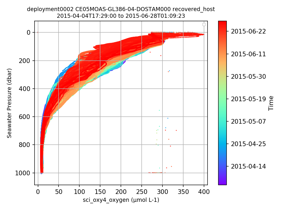 |
||
|
CE05MOAS-GL386 Deployment: 3 |
Looks like the glider started drifting - this should be annotated By Lori Garzio, on 8/30/19 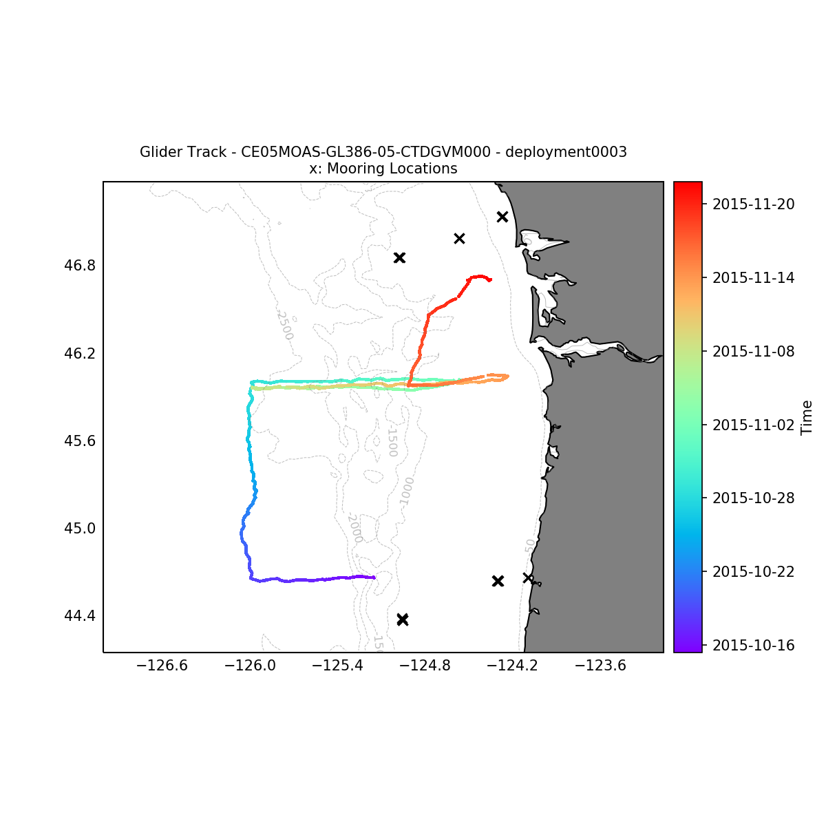 |
||
|
CE05MOAS-GL386-04-DOSTAM000 Deployment: 3 |
Suspect profile in Nov 2015 By Lori Garzio, on 8/30/19 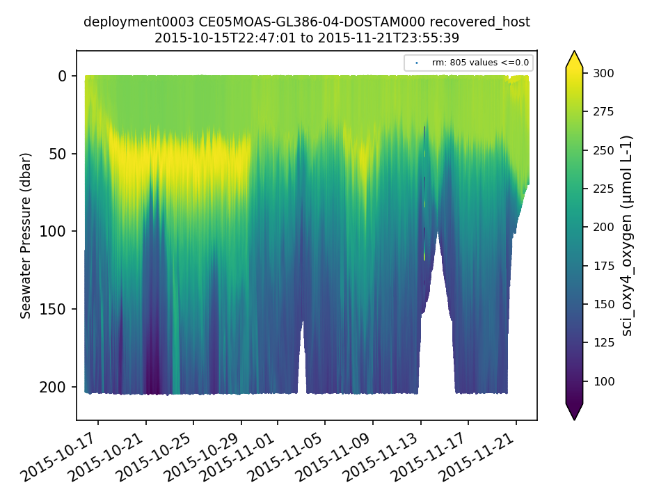 |
||
|
CE05MOAS-GL386 Deployment: 5 |
Looks like the glider started drifting - this should be annotated By Lori Garzio, on 8/30/19 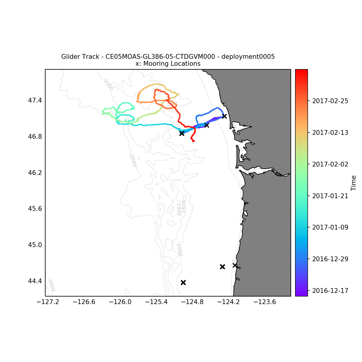 |
||
|
CE05MOAS-GL386-04-DOSTAM000 Deployment: 7 |
The deployment 7 .nc files are missing coordinates lat, lon, and pressure. By Lori Garzio, on 8/30/19 |
No annotations yet.