Single Point Velocity Meter
- Reference Designator
- CE07SHSM-RID26-04-VELPTA000
- Start Depth
- 7
- End Depth
- 7
- Location
- Near Surface Instrument Frame
- Current Status
- Review Complete
- M2M Example
- https://ooinet.oceanobservatories.org/api/m2m/12576/sensor/inv/CE07SHSM/RID26/04-VELPTA000/metadata
| Method | Data Stream | Content | Type | |
|---|---|---|---|---|
| recovered_host | velpt_ab_dcl_diagnostics_metadata_recovered | Diagnostics Metadata | Report M2M | Engineering |
| recovered_host | velpt_ab_dcl_diagnostics_recovered | Diagnostics Data | Report M2M | Engineering |
| recovered_host | velpt_ab_dcl_instrument_recovered | Data Products | Report M2M Stats | Science |
| recovered_inst | velpt_ab_diagnostics_metadata_recovered | Diagnostics Metadata | Report M2M | Engineering |
| recovered_inst | velpt_ab_diagnostics_recovered | Diagnostics Data | Report M2M | Engineering |
| recovered_inst | velpt_ab_instrument_metadata_recovered | Metadata | Report M2M | Engineering |
| recovered_inst | velpt_ab_instrument_recovered | Data Products | Report M2M Stats | Science |
| telemetered | velpt_ab_dcl_diagnostics | Diagnostics Data | Report M2M | Engineering |
| telemetered | velpt_ab_dcl_diagnostics_metadata | Diagnostics Metadata | Report M2M | Engineering |
| telemetered | velpt_ab_dcl_instrument | Data Products | Report M2M Stats | Science |
| Deployment | Cruise | Start Date | Stop Date | Mooring Asset | Node Asset | Sensor Asset | Latitude | Longitude | Deployment Depth | Water Depth |
|---|---|---|---|---|---|---|---|---|---|---|
| 1 Review | OC1503D | 04/05/2015 | 09/23/2015 | CGMCE-07SHSM-00001 | CGINS-VELPTA-11405 | 46.9861 | -124.566 | 7 | 87 | |
| 2 Review | OC1510A | 10/13/2015 | 05/13/2016 | CGMCE-07SHSM-00002 | CGINS-VELPTA-12703 | 46.9875 | -124.569 | 7 | 87 | |
| 3 Review | TN-342 | 05/05/2016 | 09/27/2016 | CGMCE-07SHSM-00003 | CGINS-VELPTA-11405 | 46.9895 | -124.569 | 7 | 87 | |
| 4 Review | AT37-03 | 09/20/2016 | 04/13/2017 | CGMCE-07SHSM-00004 | CGINS-VELPTA-11774 | 46.9859 | -124.566 | 7 | 87 | |
| 5 Review | SKQ201704S | 04/11/2017 | 10/06/2017 | CGMCE-07SHSM-00005 | CGINS-VELPTA-11820 | 46.9882 | -124.567 | 7 | 89 | |
| 6 Review | SKQ201715S | 10/03/2017 | 03/29/2018 | CGMCE-07SHSM-00006 | CGINS-VELPTA-11789 | 46.9852 | -124.564 | 7 | 87 | |
| 7 Review | SKQ201808S | 03/25/2018 | 09/20/2018 | CGMCE-07SHSM-00007 | CGINS-VELPTA-12746 | 46.9881 | -124.568 | 7 | 87 | |
| 8 Review | SR1813 | 09/18/2018 | 04/26/2019 | CGMCE-07SHSM-00008 | CGINS-VELPTA-12737 | 46.9835 | -124.564 | 7 | 87 | |
| 9 Review | SKQ201910S | 04/24/2019 | 10/12/2019 | CGMCE-07SHSM-00009 | CGINS-VELPTA-08381 | 46.9878 | -124.568 | 7 | 87 | |
| 10 Review | SKQ201921S | 10/10/2019 | CGMCE-07SHSM-00010 | CGINS-VELPTA-11789 | 46.9841 | -124.566 | 7 | 87 |
| Metadata | Start Date | End Date | Comment |
|---|---|---|---|
|
CE07SHSM-RID26-04-VELPTA000 Deployment: 1 |
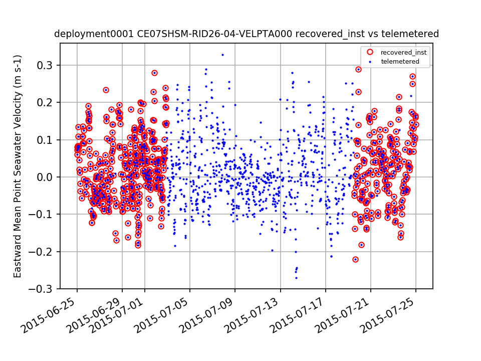
Gaps during deployment 1 should be annotated. By Lori Garzio, on 8/13/19 |
||
|
CE07SHSM-RID26-04-VELPTA000 Deployment: 1 |
7/2/15, 12:00 AM | 7/20/15, 12:00 AM | |
|
CE07SHSM-RID26-04-VELPTA000 Deployment: 2 |
|||
|
CE07SHSM-RID26-04-VELPTA000 Deployment: 4 |
|||
|
CE07SHSM-RID26-04-VELPTA000 Deployment: 6 |
|||
|
CE07SHSM-RID26-04-VELPTA000 Deployment: 7 |
There are no recovered_inst data available for download for deployment 7. According to the ingest csv, raw recovered_inst data files are available. These files should be ingested or the dataset should be annotated to explain why the recovered_inst dataset is not available. By Lori Garzio, on 8/13/19 |
| Metadata | Start Date | End Date | Comment |
|---|---|---|---|
|
CE07SHSM-RID26-04-VELPTA000 |
4/15/15, 1:15 PM |
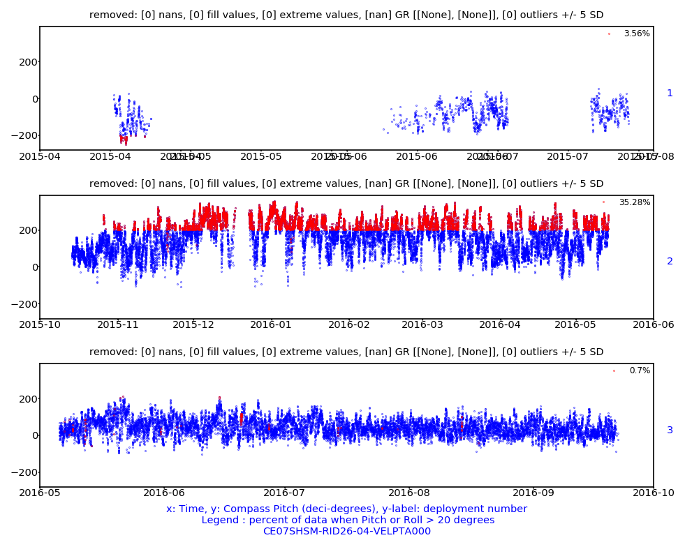
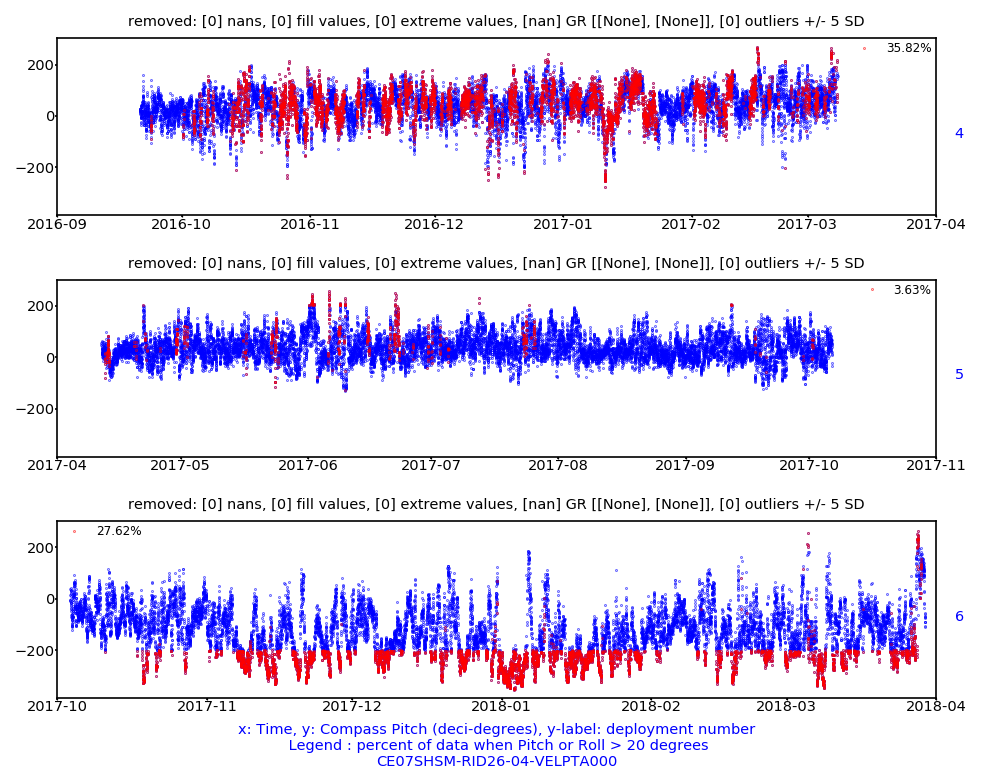
According to the manufacturer, data are suspect when the instrument is tilted more than 20 degrees (measured by pitch and roll). Id: 808 By: lgarzio |
|
|
CE07SHSM |
12/1/17, 9:35 AM | 3/25/18, 3:09 PM |
Data loss due to a power system failure. The mooring stopped receiving power from photo voltaic panel 1 of 4 on Nov-2. By Nov-20, the mooring stopped receiving power from two more solar panels (PV2 & PV4) and one of two wind turbines (WT2). This indicates the Power System Controller (PSC) they connect to is failing. Mooring components will be shut down as the mooring loses the ability to recharge its batteries.
Id: 1237
By: crisien
|
|
CE07SHSM Method: telemetered |
5/13/20, 6:40 PM |
Due to a bug in the mooring telemetry system, data during this time range was not telemetered to shore. It was recorded on the mooring and instruments and will be available in the recovered data streams.
Id: 2185
By: wingardc
|


